Yukon-Koyukuk Census Area Property Records
Yukon-Koyukuk Census Area property records are maintained by the State of Alaska through the Alaska Department of Natural Resources, Division of Mining, Land and Water. As an unorganized census area, Yukon-Koyukuk has no local borough recorder, so all land records, including deeds, liens, easements, and mining claims, are held at the DNR Recorder's office in Anchorage. The Alaska Land Records Information System (ALRIS) provides free online access to many of these documents. This guide covers where records are kept, how to search online, what to expect when requesting copies, and what types of instruments are on file for land within this vast interior Alaska census area.
Yukon-Koyukuk Census Area Overview
DNR Recorder for Yukon-Koyukuk
Because Yukon-Koyukuk is an unorganized census area, it has no local government with recording authority. The State of Alaska handles all recording functions through the Alaska Department of Natural Resources, Division of Mining, Land and Water. The DNR Recorder's office in Anchorage is the central location for all recorded land instruments affecting property in this census area. This includes the largest census area in the United States by landmass, covering a huge swath of interior Alaska.
The DNR Recorder's office is located at 550 West 7th Avenue, Suite 900, Anchorage, AK 99501. The phone number is (907) 269-8899. Staff can assist with document recording, copy requests, and questions about recorded instruments. The office handles records for multiple unorganized areas across Alaska, so having the parcel's legal description or the names of the parties involved will help staff locate documents quickly.
Recording fees follow the DNR statewide schedule, posted at dnr.alaska.gov/ssd/recoff/Fees. The standard fee is $20 for the first page of a document and $5 for each page after that. Certified copies cost $5 for the certification plus the per-page copy fee. The full directory of Alaska recording districts is at dnr.alaska.gov/ssd/recoff/distlist.
| Office | Alaska DNR, Division of Mining, Land and Water - Recorder |
|---|---|
| Address |
550 West 7th Avenue, Suite 900 Anchorage, AK 99501 |
| Phone | (907) 269-8899 |
ALRIS Online Property Record Search
The Alaska Land Records Information System (ALRIS) is the best way to start your search for Yukon-Koyukuk property records. The system is free to access at dnr.alaska.gov/landrecords. You can search by grantor name, grantee name, document type, and recording date range. Results show the document's recording number, date, and parties involved. Most documents can be downloaded as PDFs for a small per-page fee.
ALRIS covers a large portion of Alaska's recorded land documents going back several decades. For Yukon-Koyukuk, this is especially useful since the area is so vast and the recording office is in Anchorage rather than locally accessible. You can run a search from anywhere and get results without making a trip or calling the office. That said, very old documents or those from before the system's cutoff may only exist in paper form at the Anchorage office.
The Alaska Mapper system at dnr.alaska.gov/LaRS/gis/ provides GIS parcel viewing for state lands. This is useful when you need to see the physical boundaries of a parcel or check its relationship to surrounding state lands. Plat maps, surveys, and legal descriptions can also be requested through the DNR Public Information Center for parcels where GIS data is not available.
Note: ALRIS and Alaska Mapper are separate systems. ALRIS is for searching recorded documents. Alaska Mapper is for viewing parcel geography. Use both when doing thorough property research in Yukon-Koyukuk.
Types of Land Records in Yukon-Koyukuk
The DNR Recorder's office holds a wide range of property instruments for Yukon-Koyukuk. Warranty deeds and quitclaim deeds are the most common transfer documents. Mortgages and deeds of trust secure loans and are released once paid off. Judgment liens and mechanics liens can attach to property when debts are unpaid. Easements and rights-of-way give others specific access or use rights over a parcel. Subdivision plats and legal descriptions define the boundaries of parcels and lots.
Mining claims are a category of land record that is especially relevant in Yukon-Koyukuk. The census area has a long history of mining activity. Mining claims are recorded instruments that establish a claimant's right to mine minerals on a specific parcel of state or federal land. These records can overlap with and affect surface rights in some areas. When researching land in this census area, checking mining claim records as well as deed and lien records gives a fuller picture of what interests exist on a parcel.
All recorded instruments must comply with Alaska Statute Title 40, Chapter 17, which governs document recording statewide. This statute sets formatting requirements, indexing rules, and the legal effect of recording. Documents that do not meet the standards may be returned for correction before they are officially accepted.
Property Tax in Yukon-Koyukuk Census Area
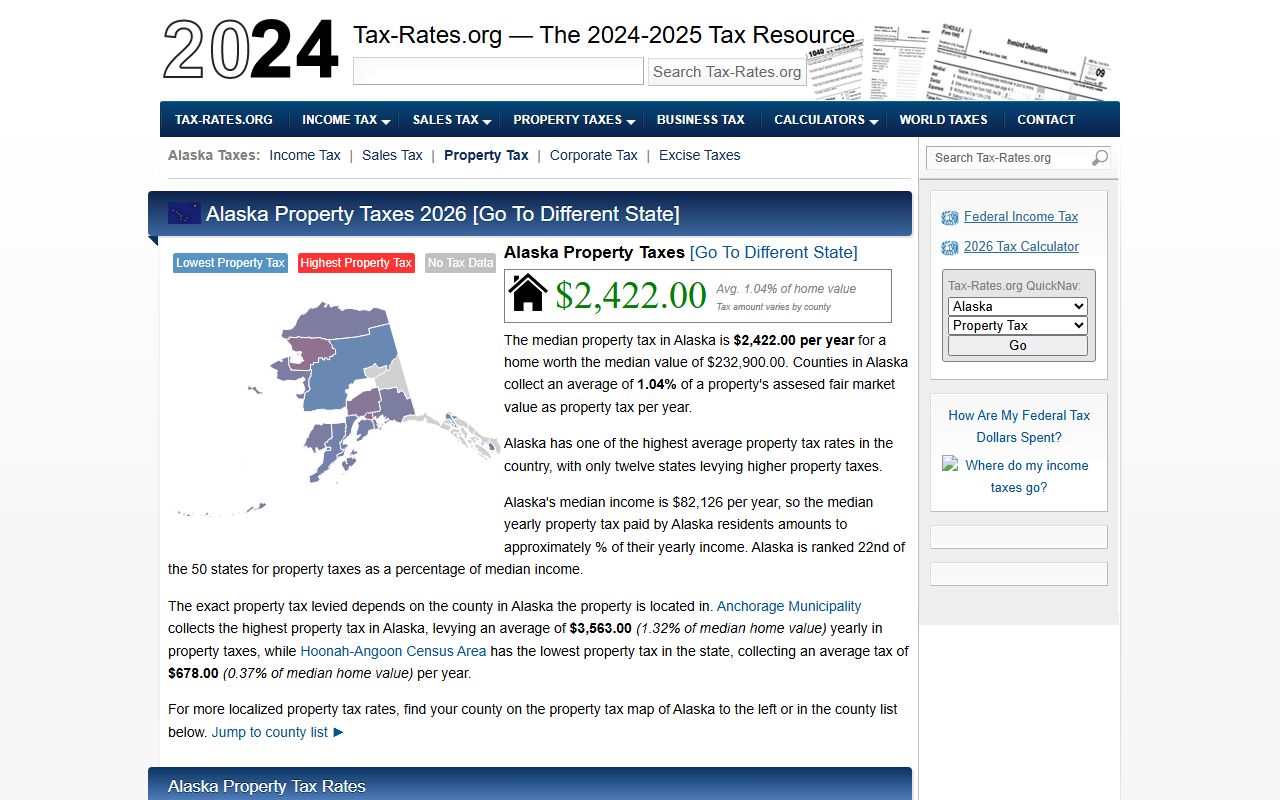
As an unorganized census area, Yukon-Koyukuk does not have a borough-level property tax. There is no local tax assessor. Most land within the census area consists of state land, federal land, and Native corporation lands, which have different tax treatment than privately owned parcels in organized boroughs. The median property tax of $750 applies to the limited number of taxable private parcels within the area.
For incorporated places within the census area, the local city governments handle their own property tax assessment and collection. Communities like Galena, Nenana, and others have their own municipal offices that deal with local tax matters. If you have questions about property taxes on a parcel within one of these communities, contact that community's city clerk or finance office directly.
For privately held rural land outside any incorporated city in Yukon-Koyukuk, property tax questions typically go to the state level through the Alaska Department of Commerce, Community and Economic Development. The DNR Recorder's office in Anchorage can help direct you to the right contact for tax-related questions on unorganized area land.
Recorded deed and title documents at the DNR office serve as the official record of ownership for all parcels, whether or not they are subject to local property tax. Even on tax-exempt or state-owned land, easements, rights-of-way, and other encumbrances are recorded and searchable through ALRIS.
Communities in Yukon-Koyukuk Census Area
The Yukon-Koyukuk Census Area is the largest census area in the United States by size. It contains many small communities including Galena, Nenana, Anvik, Holy Cross, Kaltag, Nulato, Ruby, and others. None of these communities meet the population threshold for a separate city page on this site. All deed and title records for land within the census area are handled through the DNR Recorder in Anchorage. Local city clerks in the individual communities handle municipal records and tax matters within their city limits.
Nearby Areas in Alaska
These neighboring census areas and boroughs also file property records through Alaska DNR recording offices.